So you’ve found the right property, your PropertEASE report tells you that you may be able to achieve a 1 into 2 subdivision, or build 4x townhouses, but what else should you be looking at?
PropertEASE tells you some of the cautionary overlays that could negatively impact upon the development potential of a property, these include things like Flooding, Character/Heritage, Landslide Hazard, Bushfire…etc. but how exactly can they impact the development of a site?
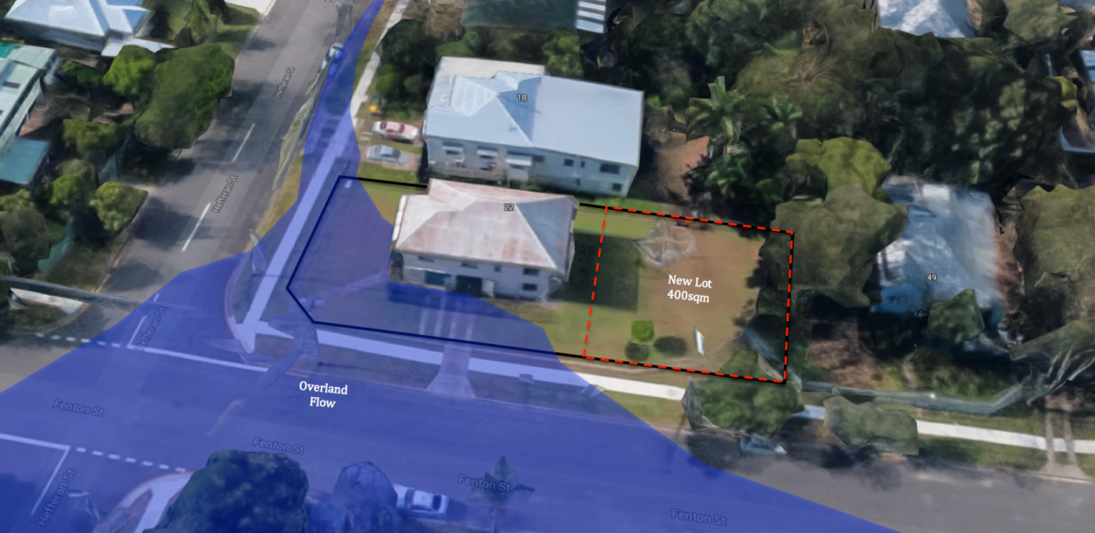
If you see the word ‘flood’ on a property, it is a huge red-flag that requires further investigation. You can review the mapping on PropertEASE to see where the site may be affected but I would also recommend going to your Local Council website and seeing if they provide any additional flooding information. For example, Brisbane has ‘FloodWise Property Reports’ and Moreton Bay have ‘Flood Check Reports’. These reports will identify exactly how impacted the site is by flooding and therefore how restrictive it might be on a development. For example, the whole site goes 5m underwater every 2 years or the corner of the site might go under 1cm every 100 years. I recommend talking with a local hydraulic engineer about any site that is affected by flooding.
‘Character’ or ‘heritage’ are more keywords that should prompt a bit more attention. Generally speaking, a ‘character’ or ‘heritage’ overlay will restrict the demolition or alteration of the existing building on the site. This may mean that the building would need to be fully retained as part of a subdivision or multiple unit developments. Dependant on the location or size of the ‘character’ building, it might completely stop a project from proceeding. I see a lot of these cases in the older suburbs of Brisbane where a character house will be sitting on two allotments. I would recommend chatting with a local town planner or heritage architect about any character overlays and how they could impact upon a development.
Biodiversity and/or significant vegetation overlays (e.g. Environmental Significance) are regularly used to protect the native vegetation on an allotment. Thereby, restricting the amount of developable land on a site. The PropertEASE mapping will identify these areas and any future development may require specialist input from an ecologist.
A bushfire hazard is another overlay that could become a major issue when attempting to increase the residential density in an area. If a property is within a risk/hazard area, Council will more than likely not allow you to increase the density as it increases the hazard to the safety of people. I recommend looking at the PropertEASE mapping to identify the location of the Bushfire Hazard and talking to a local Bushfire Consultant about the risks associated. You will more than likely be required to get a bushfire hazard assessment.
Other than the obvious cautionary overlays, there are some other key issues to take into consideration when looking at a development site. The slope of a lot can greatly impact upon the development potential of a site. If the site is sloping towards the rear boundary, you may be required to get a lawful point of discharge for stormwater through an adjoining landowner. This can completely stop a project if the consent for the discharge cannot be obtained from the adjoining landowner. I would recommend looking for sites that slope towards the street frontage or towards some stormwater infrastructure.
The location of the infrastructure and services can also have major impacts on the development of a site. I recommend utilising the free service at Dial Before You Dig to search the location of all the infrastructure on a site. This will ensure a major part of infrastructure isn’t running through the middle of a site and the sewer, stormwater, and water could easily be accessed.
Although this isn’t the full list of issues, it is certainly a good start. What is my best advice? Once you think you have found the right property using PropertEASE, give a local town planner a call to discuss the potential for more complicated issues.

